Items related to Bradshaw's Railway Map 1907: Great Britain & Ireland:...

Rare book
"synopsis" may belong to another edition of this title.
- PublisherOld House Books
- Publication date2006
- ISBN 10 1873590334
- ISBN 13 9781873590331
- BindingMap
- EditorEdward Allhusen
- Rating
Top Search Results from the AbeBooks Marketplace

Stock Image
Bradshaw's Railway Folded Map 1907
Published by
Old House Books
(2006)
ISBN 10: 1873590334
ISBN 13: 9781873590331
Used
Paperback
Quantity: 1
Seller:
Rating
Book Description Paperback. Condition: Fair. A readable copy of the book which may include some defects such as highlighting and notes. Cover and pages may be creased and show discolouration. Seller Inventory # GOR002004436
Buy Used
US$ 2.84
Convert currency
Seller Image
Bradshaw's Railway Folded Map 1907
Seller:
Rating
Book Description Condition: VeryGood. Most items will be dispatched the same or the next working day. Seller Inventory # wbs2716322242
Buy Used
US$ 1.00
Convert currency
Seller Image
Bradshaw's Railway Folded Map 1907
Seller:
Rating
Book Description Condition: Good. Most items will be dispatched the same or the next working day. Seller Inventory # wbs5119553082
Buy Used
US$ 1.00
Convert currency
Stock Image
Bradshaw's Railway Folded Map 1907
Published by
Bloomsbury Publishing PLC, United Kingdom, London
(2004)
ISBN 10: 1873590334
ISBN 13: 9781873590331
Used
Paperback
Quantity: 4
Seller:
Rating
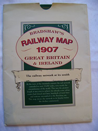
Book Description Paperback. Condition: Very Good. A detailed map of the railway network at its zenith. At the turn of the twentieth century the rail network in Britain and Ireland extended to over 23,000 miles, very nearly the circumference of the world. This was the greatest length it was ever to achieve for already some urban routes had lost the fight with electric trams and, later, culminating in the Beeching axe, hundreds of rural lines and stations were closed. This map shows the network in its heyday before the decline commenced. This map shows lines in England, Scotland, Wales and Ireland with detailed enlargements of the major conurbations. The great main lines with major stations and termini are marked as well as many small village halts on the humble country branch lines. The map bears witness to the culmination of the gargantuan engineering feat which produced 23,000 route miles in the 82 years since the first 25 miles of railway was completed between Stockton and Darlington in 1825. Compare that to the less than 11,000 miles we have a century later and use the map to explore the hundreds of routes, with their stations, which ran through so many parts of the country but survived for no more than a few generations before succumbing to the march of progress which favoured alternative means of transport. The book has been read, but is in excellent condition. Pages are intact and not marred by notes or highlighting. The spine remains undamaged. Seller Inventory # GOR001697976
Buy Used
US$ 5.66
Convert currency
Bradshaw's Railway Map 1907 : Great Britain & Ireland
Seller:
Rating
Book Description paperback. Condition: Very Good. No Jacket. folding paper map in very good condition, housed in a paper wallet which is chipped at one corner, Seller Inventory # 267831
Buy Used
US$ 7.70
Convert currency
Seller Image
Bradshaw's Railway Map 1907 Great Britain & Ireland
Published by
Old House Books, Moretonhampstead
(2004)
ISBN 10: 1873590334
ISBN 13: 9781873590331
Used
Quantity: 1
Seller:
Rating
Book Description Map-folded. Condition: Near Fine. Very lightly marked wallet else as new. Folded map with booklet. Seller Inventory # C355
Buy Used
US$ 6.58
Convert currency
Seller Image
Bradshaw's Railway Folded Map 1907
Published by
Old House, UK
(2004)
ISBN 10: 1873590334
ISBN 13: 9781873590331
Used
Soft cover
Quantity: 1
Seller:
Rating
Book Description Soft cover. Condition: Very Good. Folded map in sleeve. Seller Inventory # 74537
Buy Used
US$ 8.56
Convert currency
Bradshaw's Railway Folded Map 1907 PLUS 1897 London Railways Map PLUS Isambard Kingdom Brunel
Seller:
Rating
Book Description No Binding. Condition: Very Good. 2 maps plus one booklet. Seller Inventory # 73632
Buy Used
US$ 13.16
Convert currency
Bradshaw's Railway Map, 1907 : Great Britain and Ireland
Published by
Old House Books, Moretonhampstead, UK
(2006)
ISBN 10: 1873590334
ISBN 13: 9781873590331
Used
Soft cover
Quantity: 1
Seller:
Rating
Book Description Soft cover. Condition: Very Good. Large fold-out map showing the network in its heyday, before the decline commenced with detailed enlargements of the major conurbations. Very good clean copy. Seller Inventory # 009238
Buy Used
US$ 13.16
Convert currency
Stock Image
Bradshaw's Railway Folded Map 1907
Published by
Old House 2004-01-01
(2004)
ISBN 10: 1873590334
ISBN 13: 9781873590331
Used
Quantity: 2
Seller:
Rating
Book Description Map. Condition: Fine. some shelf wear but the content new throughout. Seller Inventory # 124443-4
Buy Used
US$ 10.52
Convert currency