Order Total (1 Item Items):
Shipping Destination:

Compiled Drawn Cartographic Section National (12 results)
Skip to main search results
Product Type
- All Product Types
- Books (1)
- Magazines & Periodicals
- Comics
- Sheet Music
- Art, Prints & Posters
- Photographs
- Maps (11)
- Manuscripts & Paper Collectibles
Condition
Binding
- All Bindings
- Hardcover
- Softcover (10)
Collectible Attributes
- First Edition (12)
- Signed
- Dust Jacket
- Seller-Supplied Images (1)
- Not Print on Demand (12)
Free Shipping
- Free US Shipping
Seller Location
Seller Rating
-

West Indies : The National Geographic Magazine
Published by National Geographic Society, Washington D.C, 1954
Seller: J J Basset Books, bassettbooks, bookfarm.co.uk, Peter Tavy, United Kingdom
Seller Rating:

Map First Edition
Fold Out Map. Condition: Near Fine. No Jacket. Compiled & Drawn in the Cartographic Section of the National Geographic Society (illustrator). First Edition. Please Email for further details. Size: 8vo - over 7�" - 9�" (Folded). Not Signed or Inscribed. Fold Out Map.
-
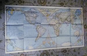
The World Map : The National Geographic Magazine
Published by National Geographic Society, Washington D.C, 1951
Seller: J J Basset Books, bassettbooks, bookfarm.co.uk, Peter Tavy, United Kingdom
Seller Rating:
Map First Edition
Fold Out Map. Condition: Very Good. No Jacket. Compiled & Drawn in the Cartographic Section of the National Geographic Society (illustrator). First Edition. Please Email for further details. Size: 8vo - over 7�" - 9�" (Folded). Not Signed or Inscribed. Fold Out Map.
-
North America : The National Geographic Magazine Vol C1 No. 3
Published by National Geographic Society, Washington D.C, 1952
Seller: J J Basset Books, bassettbooks, bookfarm.co.uk, Peter Tavy, United Kingdom
Seller Rating:
Map First Edition
Fold Out Map. Condition: Near Fine. No Jacket. Compiled & Drawn in the Cartographic Section of the National Geographic Society (illustrator). First Edition. Please Email for further details. Size: 8vo - over 7�" - 9�" (Folded). NOT SIGNED OR INSCRIBED. Fold Out Map.
-
Northern Europe : The National Geographic Magazine
Published by National Geographic Society, Washington D.C, 1954
Seller: J J Basset Books, bassettbooks, bookfarm.co.uk, Peter Tavy, United Kingdom
Seller Rating:
Map First Edition
Fold Out Map. Condition: Very Good Closed Tears. No Jacket. Compiled & Drawn in the Cartographic Section of the National Geographic Society (illustrator). First Edition. Please Email for further details. Size: 8vo - over 7�" - 9�" (Folded). Not Signed or Inscribed. Fold Out Map.
-
Central Europe Including the Balkan States : The National Geographic Magazine
Published by National Geographic Society, Washington D.C, 1951
Seller: J J Basset Books, bassettbooks, bookfarm.co.uk, Peter Tavy, United Kingdom
Seller Rating:
Map First Edition
Fold Out Map. Condition: Near Fine. No Jacket. Compiled & Drawn in the Cartographic Section of the National Geographic Society (illustrator). First Edition. Please Email for further details. Size: 8vo - over 7�" - 9�" (Folded). Not Signed or Inscribed. Fold Out Map.
-
Africa and the Arabian Peninsula : The National Geographic Magazine
Published by National Geographic Society, Washington D.C, 1950
Seller: J J Basset Books, bassettbooks, bookfarm.co.uk, Peter Tavy, United Kingdom
Seller Rating:
Map First Edition
Fold Out Map. Condition: Near Fine. No Jacket. Compiled & Drawn in the Cartographic Section of the National Geographic Society (illustrator). First Edition. Please Email for further details. Size: 8vo - over 7�" - 9�" (Folded). Not Signed or Inscribed. Fold Out Map.
-
Mexico and Central America : The National Geographic Magazine Vol CIII No. 3
Published by National Geographic Society, Washington D.C, 1953
Seller: J J Basset Books, bassettbooks, bookfarm.co.uk, Peter Tavy, United Kingdom
Seller Rating:
Map First Edition
Fold Out Map. Condition: Near Fine. No Jacket. Compiled & Drawn in the Cartographic Section of the National Geographic Society (illustrator). First Edition. Please Email for further details. Size: 8vo - over 7�" - 9�" (Folded). Not Signed or Inscribed. Fold Out Map.
-
South America : The National Geographic Magazine Vol XCVIII No.4
Published by National Geographic Society, Washington D.C, 1950
Seller: J J Basset Books, bassettbooks, bookfarm.co.uk, Peter Tavy, United Kingdom
Seller Rating:
Map First Edition
Fold Out Map. Condition: Near Fine. No Jacket. Compiled & Drawn in the Cartographic Section of the National Geographic Society (illustrator). First Edition. Please Email for further details. Size: 8vo - over 7�" - 9�" (Folded). Not Signed or Inscribed. Fold Out Map.
-
The Far East : The National Geographic Magazine
Published by National Geographic Society, Washington D.C, 1952
Seller: J J Basset Books, bassettbooks, bookfarm.co.uk, Peter Tavy, United Kingdom
Seller Rating:
Map First Edition
Fold Out Map. Condition: Near Fine. No Jacket. Compiled & Drawn in the Cartographic Section of the National Geographic Society (illustrator). First Edition. Please Email for further details. Size: 8vo - over 7�" - 9�" (Folded). Not Signed or Inscribed. Fold Out Map.
-
Atlantic Ocean : The National Geographic Magazine
Published by National Geographic Society, Washington D.C, 1955
Seller: J J Basset Books, bassettbooks, bookfarm.co.uk, Peter Tavy, United Kingdom
Seller Rating:
Map First Edition
Fold Out Map. Condition: Very Good. No Jacket. Compiled & Drawn in the Cartographic Section of the National Geographic Society (illustrator). First Edition. Please Email for further details. Size: 8vo - over 7�" - 9�" (Folded). Not Signed or Inscribed. Fold Out Map.
-
A Map of the World; Rare Excl. cond. December 1941
Published by National Geographic Society (U.S.), 1941
Map First Edition
No Binding. Condition: Very Good. 1st Edition. A Map of the World; sheet map (folded) Excellent no marks supple paper no pin holes at corners. Grosvenor, Gilbert [Editor] | Darley, James M [Cartographer] Material type: Map Map Publisher: Washington, D.C. : National Geographic Society, 1941 Description: 1 map : color ; 2 hemispheres, each 50 cm in diam., on sheet 56 x 104 cm, folded to 16 x 21 cm James Darley, Chief Cartographer. , Scale 1:35,000,000 ; Azimuthal equal area projection; (W 180°--E 180°/N 90°--S 90°). - 1 map : color ; 2 hemispheres, each 50 cm in diam., on sheet 56 x 104 cm, folded to 16 x 21 cm Relief shown by hachures and spot heights. "International boundaries as of Sept. 1, 1939." "December, 1941." Ancillary maps: World mapping -- Time zones -- Land hemisphere -- Water hemisphere -- Density of population (Western hemisphere) -- Density of population (Eastern hemisphere). Insets: Land Hemisphere -- World mapping -- Water hemisphere -- Time zones -- Density of population.
-
Africa and the Arabian Peninsula
Published by National Geographic Society, Washington DC, 1950
First Edition
Condition: Good. Approximately 28 inches by 31 inches. Has color. This map was prepared for the National Geographic Magazine. Scale is 12.000.000 or 1894 miles to the inch. Section of Geographic equivalents and abbreviations. Folded into 15 panels (one sided). Insert of the Cape Verde Islands. Insert of a Physical Map of Africa. Text insert entitled "Political Administration in Africa" which includes some United Nations Trusteeships. Founded in 1915 as the Map Department of the National Geographic Society, National Geographic Maps is responsible for illustrating the world around us through the art and science of mapmaking. Today, National Geographic Maps continues this mission by creating the world's best wall maps, outdoor recreation maps, travel maps, atlases and globes that inspire people to care about and explore their world. The chief cartographer was James M. Darley. Compilation was performed by H.C. Bryan, R. W. Collins, R. I. Darley, A. D. Grazzini, A. E. Holdstock, and R. E. McAleer. The relief was by John J. Brehm. A map is a symbolic representation of selected characteristics of a place, usually drawn on a flat surface. Maps present information about the world in a simple, visual way. They teach about the world by showing sizes and shapes of countries, locations of features, and distances between places. Maps can show distributions of things over the Earth, such as settlement patterns. They can show exact locations of houses and streets in a city neighborhood. Mapmakers, called cartographers, create maps for many different purposes. Vacationers use road maps to plot routes for their trips. Meteorologists-scientists who study the weather-use weather maps to prepare forecasts. City planners decide where to put hospitals and parks with the help of maps that show land features and how the land is currently being used. Some common features of maps include scale, symbols, and grids.All maps are scale models of reality. A map's scale indicates the relationship between the distances on the map and the actual distances on Earth. This relationship can be expressed by a graphic scale, a verbal scale, or a representative fraction. The most common type of graphic scale looks like a ruler. Also called a bar scale, it is simply a horizontal line marked off in miles, kilometers, or some other unit of measuring distance. The verbal scale is a sentence that relates distance on the map to distance on Earth. For example, a verbal scale might say, "One centimeter represents one kilometer" or "One inch represents eight miles." The representative fraction does not have specific units. It is shown as a fraction or ratio-for example, 1/1,000,000 or 1:1,000,000. This means that any given unit of measure on the map is equal to one million of that unit on Earth. So, 1 centimeter on the map represents 1,000,000 centimeters on Earth, or 10 kilometers. One inch on the map represents 1,000,000 inches on Earth, or a little less than 16 miles. The size of the area covered helps determine the scale of a map. A map that shows an area in great detail, such as a street map of a neighborhood, is called a large-scale map because objects on the map are relatively large. A map of a larger area, such as a continent or the world, is called a small-scale map because objects on the map are relatively small.Cartographers use symbols to represent geographic features. For example, black dots represent cities, circled stars represent capital cities, and different sorts of lines represent boundaries, roads, highways, and rivers. Colors are often used as symbols. Green is often used for forest, tan for deserts, and blue for water. A map usually has a legend, or key, that gives the scale of the map and explains what the various symbols represent. Some maps show relief, or changes in elevation. A common way to show relief is contour lines, also called topographic lines. These are lines that connect points that have equal elevation. If a map shows a large enough area, contour lines form.